

Retaining Wall Site Survey: What the Survey Covers
Learn what a retaining wall site survey covers: slope and elevation measurements, property lines, drainage and soil, and how the findings shape your project.
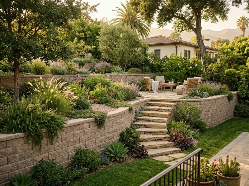
A retaining wall site survey is the process of measuring and documenting your property before a wall is designed or built. It records the shape of the ground, the height changes along the proposed wall line and the property boundaries. It also notes anything nearby that could affect the project. Done early, it replaces guesswork with real numbers. That is one reason well-planned walls go in on budget and stay standing.
Not every project needs the same level of survey. A small garden wall on a gentle slope may only need a contractor’s site assessment. A tall wall near a property line, a structure or a steep hillside usually calls for a formal survey. This guide explains what a retaining wall site survey covers, who performs it and how the information gets used.

What Is a Retaining Wall Site Survey?
The term covers a range of site records. At the simplest end, an experienced contractor walks the property, takes measurements and notes conditions that affect the wall. This is a site assessment or site evaluation. It informs the design and the quote, but it is not a legal survey.
At the formal end, a licensed land surveyor measures the property with survey-grade instruments. The fieldwork is then turned into a stamped drawing. Two survey types cover most retaining wall work. A topographic survey maps the shape and features of the land. A boundary survey locates the legal property lines. Many projects combine the two into one set of survey plans.
What the Survey Covers
Slope, Elevations and Existing Grades
The heart of most retaining wall surveys is the ground itself. A topographic survey records spot elevations across the site and turns them into contour lines. Each contour line connects points at the same height. Lines packed close together mean steep ground. Lines spread apart mean a gentle slope.
Along the proposed wall line, the survey shows the existing grade, meaning the current height of the ground before digging or filling. That profile decides how tall each section of wall must be and where stepped sections make sense. Survey data also sets the proposed grade, the planned ground level after construction. Guessing these numbers from a photo can easily miss a two- or three-foot change in elevation.
Property Lines, Easements and Boundary Markers
Walls near a property line need exact information. Footings and drainage gravel often extend wider than the visible wall face. A wall that looks fine at the surface can still put buried parts on a neighbor’s land. A boundary survey locates the legal lines and any boundary markers, and it can reveal easements. An easement gives someone else, often a utility company, rights over part of your lot, and some easements do not allow permanent walls.
Nearby Structures and Site Constraints
The survey documents what already sits near the work area: the house, garage and foundations, driveways, sidewalks, fences, patios and mature trees. It also notes practical limits such as available working space and access for equipment. These details shape where the wall can go. A wall that blocks access to a utility structure will need a different plan. So will one that sits against a large tree’s roots.

Soil and Drainage Conditions
Water causes more retaining wall failures than anything else. Wet soil gets heavy and pushes hard against the back of a wall. A site survey maps surface water and drainage patterns. It shows where water flows across the lot, where it pools after rain and where downspouts empty. It also shows whether a neighbor’s yard sends runoff toward the wall area. Low, flood-prone spots and natural drainage paths get flagged for the designer.
A survey shows the shape of the ground but not its strength. Soil conditions such as soft clay, loose fill or a high groundwater level affect how the wall must be founded. Where the site or the wall height calls for it, a geotechnical engineer takes soil samples and issues a report. The survey and the soils report work together, one describing the surface and the other what lies below it.
A Contractor’s Assessment Is Not a Licensed Survey
These are different services, and California law draws the line clearly. Under the Professional Land Surveyors’ Act, only a licensed land surveyor, or someone working under a surveyor’s responsible charge, may practice land surveying. That legal definition includes locating property lines and boundaries, setting survey monuments and preparing maps based on that work.
A design-build contractor can assess your site, measure grades for planning and tell you what the project needs. DIY checks are fine for early questions, but they are not a substitute for measured data once design begins. That assessment guides early decisions. But some jobs call for the formal version. A wall on or near a boundary, a disputed line, an easement or plans a building department must approve all belong to a licensed professional. Ridgeline Outdoor Living is a landscape and retaining-wall construction company, not a land-surveying practice. When a project requires a formal survey, we work with licensed surveyors.
How Designers, Engineers and Contractors Use Survey Information
Survey data flows through the whole project. The designer uses the existing grades and constraints to place the wall and set its height. The engineer, when one is required, uses the elevations and soil information for the engineering: loads, footing depths and drainage sizing. The contractor uses the same drawing to plan excavation, estimate earthwork and schedule equipment.
Surveys also feed the permit process. In Glendale and across Greater Los Angeles, many retaining walls require a building permit when height, location or loading triggers local rules. Glendale’s published permit guidance states that freestanding fences and walls generally need a building permit when a retaining wall is 4 feet or taller as measured from the top of the wall to the bottom of the footing, or when the wall is adjacent to slopes, the public right-of-way or other structures, or when it carries additional surcharge. Thresholds and site-plan requirements differ by city and by project, so confirm the current rules with Glendale Building and Safety before you submit plans. Permit site plans typically must show the wall location, top-of-wall and footing elevations, slope and drainage patterns. Accurate survey numbers make those drawings straightforward instead of a source of corrections.
The information keeps working after design. Construction staking transfers the plan onto the ground, so the crew builds the wall in the surveyed position and to the surveyed heights. After the work is done, an as-built survey can record what was actually constructed. One accurate set of data ties the whole job together.

What Happens After the Survey
With the survey complete, the project moves in a clear order. The design is finished using the measured grades and constraints. If soil conditions or wall height require it, a geotechnical report is added. Plans go to the building department where a permit applies, and permit inspections follow the same approved drawings. Before digging, a call to 811 gets underground utilities marked, and those marks are checked against the survey. Then construction begins with staking based on the survey control points.
For the homeowner, the survey’s value is simple. It lowers risk. Problems like hidden grade changes, encroaching footings and blocked drainage are far cheaper to fix on paper than after the blocks are stacked.
Frequently Asked Questions
What is the difference between a topographic survey and a boundary survey?
A topographic survey maps the shape of the land: elevations, contours, slopes and features such as trees, driveways and buildings. A boundary survey locates the legal property lines and corners. Retaining wall projects near a lot line often need both, and surveyors can usually combine them into one drawing.
Can I use an old survey for my retaining wall project?
An older survey may still be accurate for boundaries, but it may not show current grades. Yards change over time through landscaping, regrading, erosion and nearby construction. Your designer or engineer may want fresh elevation data for the wall area. Ask the surveyor whether an update is enough or a new survey makes more sense.
Does every retaining wall need a formal survey?
No. A low garden wall on open, gently sloped ground may only need a contractor’s site assessment. Formal surveys earn their cost on taller walls, walls near a property line or structure, steep hillside terrain and projects that need a permit. A good contractor will tell you which level of survey work your project needs.
The Bottom Line
A retaining wall site survey turns an unknown slope into measured ground. It documents elevations, boundaries, structures, soil and drainage before anyone designs or digs. It gives designers, engineers and builders one shared set of facts. That is what keeps wall heights right, footings on your side of the line and water moving away from the wall.
Ridgeline Outdoor Living plans and builds retaining walls and hillside outdoor projects across Greater Los Angeles, including retaining wall and landscaping work in Glendale. If your property has slopes, tricky grades or boundary questions, the right first step is understanding the site itself.
A free on-site consultation, a phased budget tier, and a master plan that fits your property and your goals.